
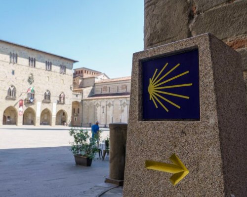
A wonderful all-Tuscan "Way of St. James". Walking to the "minor Santiago" among history, nature and cities of art
From Florence to Livorno, passing through Prato, Pistoia, Lucca and Pisa, the Jacobean itinerary winds its way through picturesque hills and historic villages, touching on the main art cities of northern Tuscany. A fascinating route divided into six easy and medium level stages where nature rhymes with culture, for about 170 kilometers that run along the ancient Roman routes of the Via Cassia and the Via Aemilia Scauri.
Steps steeped in history, following in the footsteps of the pilgrims who went to Livorno to sail from the Livorno port and land in Barcelona, taking the Catalan Jacobean routes and then the French Way, to reach Santiago de Compostela.
A section of the road network that connects to the Way of St. James, yesterday as today, the Way of St. Jacopo finds its sublimation in Pistoia, called the "minor Santiago" or "Italian Compostela", because since 1145 A.D. it has guarded in the cathedral of San Zeno the famous relic of the Apostle James (Jacopo), a bone fragment of the skull believed to be authentic. Lorenzo Ghiberti's reliquary is in the Chapel of the Crucifix or of the Judgment, in front of the Silver Altar, a grand example of goldsmithing, on which the best craftsmen of the time worked between 1287 and 1456, including a young Brunelleschi.
Between faith, art and the most beautiful Tuscan sights, the Way of St. Jacopo is a wonderful walking adventure.
The first stage connects the two most densely populated and urbanized cities in Tuscany; it takes place mainly on paved roads but keeping to a quiet alternative road network avoiding city chaos, minimizing suburbs and industrial areas and involving numerous historical landmarks.
Along this stretch, which has little uphill gradient, there are tabernacles, parish churches, ancient mansions such as the Medici Villa in Careggi, glimpses of the more classic Tuscan countryside, Etruscan and industrial archaeological sites and fortifications, such as the Castle in Calenzano. An artistic and historical heritage that adds to the already rich heritage of Florence and Prato.
- straighten
Length26,8 km
-
DifficultyEasy
- height
Overall altitude difference190 m
As you leave Prato, you continue along the Bisenzio River and the environment around becomes more natural. This is a stage considered to be of medium level not so much for its length as for the uphill elevation gain, which also involves protected areas such as Monteferrato, where the highest point of about 350 m above sea level is reached, a natural balcony from which the city of Pistoia and its dome can already be appreciated. Descending to the valley, one intercepts the Montemurlo Castle and the placid countryside of Montale, and then enters the walls of Pistoia, notices near Piazza del Duomo a memorial stone with the symbol of the Way of St. James and arrives at the San Zeno Cathedral, the culmination of the second stage.
As you leave Prato, you continue along the Bisenzio River and the environment around becomes more natural. This is a stage considered to be of medium level not so much for its length as for the uphill elevation gain, which also involves protected areas such as Monteferrato, where the highest point of about 350 m above sea level is reached, a natural balcony from which the city of Pistoia and its dome can already be appreciated. Descending to the valley, one intercepts the Montemurlo Castle and the placid countryside of Montale, and then enters the walls of Pistoia, notices near Piazza del Duomo a memorial stone with the symbol of the Way of St. James and arrives at the San Zeno Cathedral, the culmination of the second stage.
- straighten
Length27,3 km
-
DifficultyAverage
- height
Overall altitude difference350 m
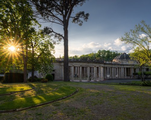
The itinerary becomes very varied, crossing hills, villages, castles, Romanesque churches and winding along paths and paved roads. A scenic up and down of villages and hillocks that makes this stretch again a medium level stage, at a time of places full of history and charm such as the parish church of Groppoli and the castle of Serravalle, and of relaxation such as the Montecatini hot springs. As you go up and down, you will cross fortified villages such as the so-called citrus village, the charming Buggiano Castello, Stignano and Uzzano, from which you can see a splendid panorama of the Valdinievole and Pescia.
The itinerary becomes very varied, crossing hills, villages, castles, Romanesque churches and winding along paths and paved roads. A scenic up and down of villages and hillocks that makes this stretch again a medium level stage, at a time of places full of history and charm such as the parish church of Groppoli and the castle of Serravalle, and of relaxation such as the Montecatini hot springs. As you go up and down, you will cross fortified villages such as the so-called citrus village, the charming Buggiano Castello, Stignano and Uzzano, from which you can see a splendid panorama of the Valdinievole and Pescia.
- straighten
Length29,3 km
-
DifficultyAverage
- height
Overall altitude difference300 m
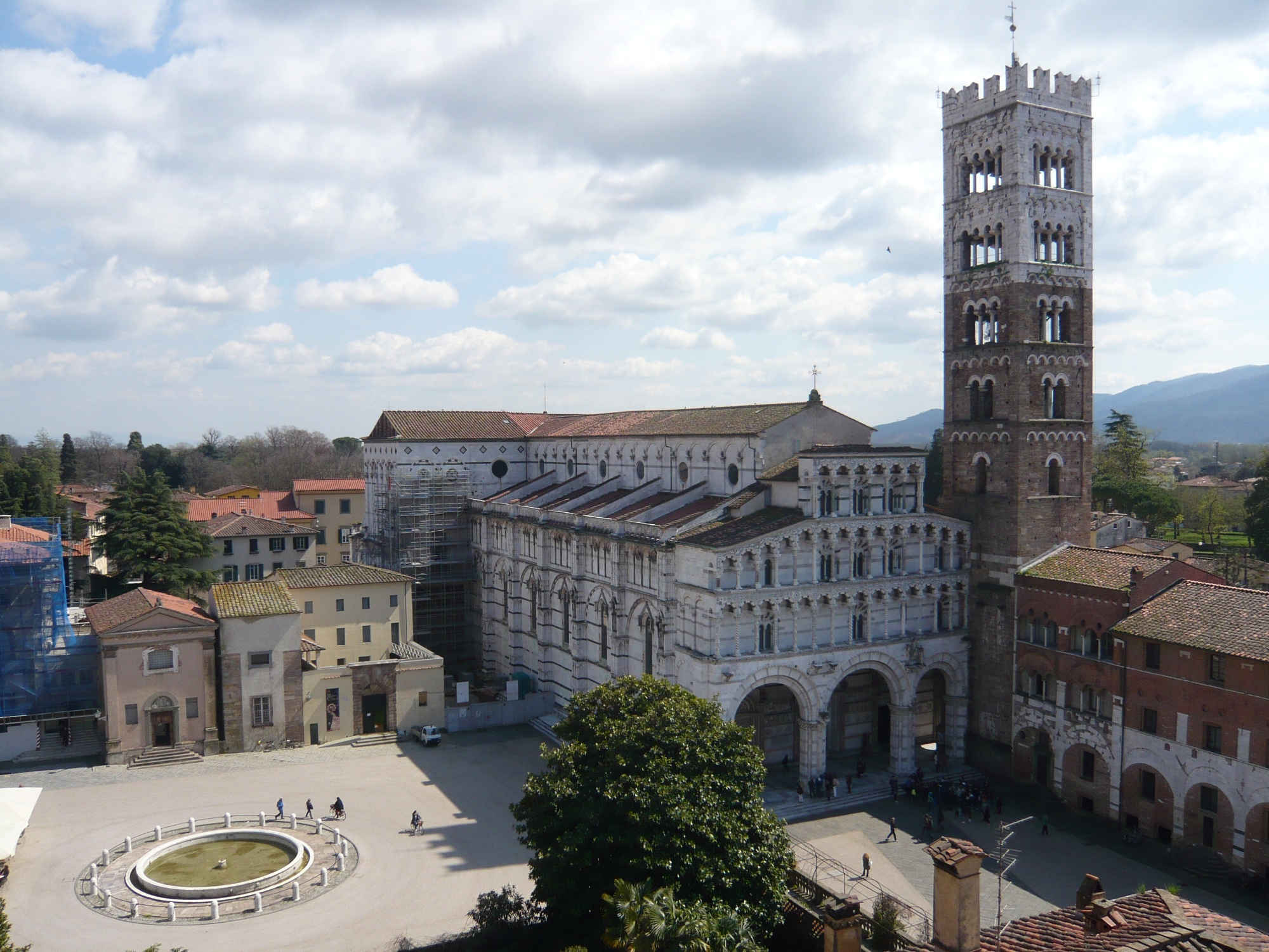
The route leaving Pescia is still characterized by elevations, although the stage is at an easy level, and it soon reaches the spectacular architectural complex of Collodi and Villa Garzoni, the village of Pinocchio. A succession of other delightful villages such as Petrognano and Segromigno in Monte, also custodians of ancient luxurious villas such as Villa Mansi, and you reach the vicinity of the Serchio River. Skirting its waters that sometimes turn deep green, one arrives in Lucca and in the presence of the Cathedral of San Martino, where the ancient and venerated wooden crucifix of the "Holy Face" is preserved.
The route leaving Pescia is still characterized by elevations, although the stage is at an easy level, and it soon reaches the spectacular architectural complex of Collodi and Villa Garzoni, the village of Pinocchio. A succession of other delightful villages such as Petrognano and Segromigno in Monte, also custodians of ancient luxurious villas such as Villa Mansi, and you reach the vicinity of the Serchio River. Skirting its waters that sometimes turn deep green, one arrives in Lucca and in the presence of the Cathedral of San Martino, where the ancient and venerated wooden crucifix of the "Holy Face" is preserved.
- straighten
Length24,6 km
-
DifficultyEasy
- height
Overall altitude difference190 m
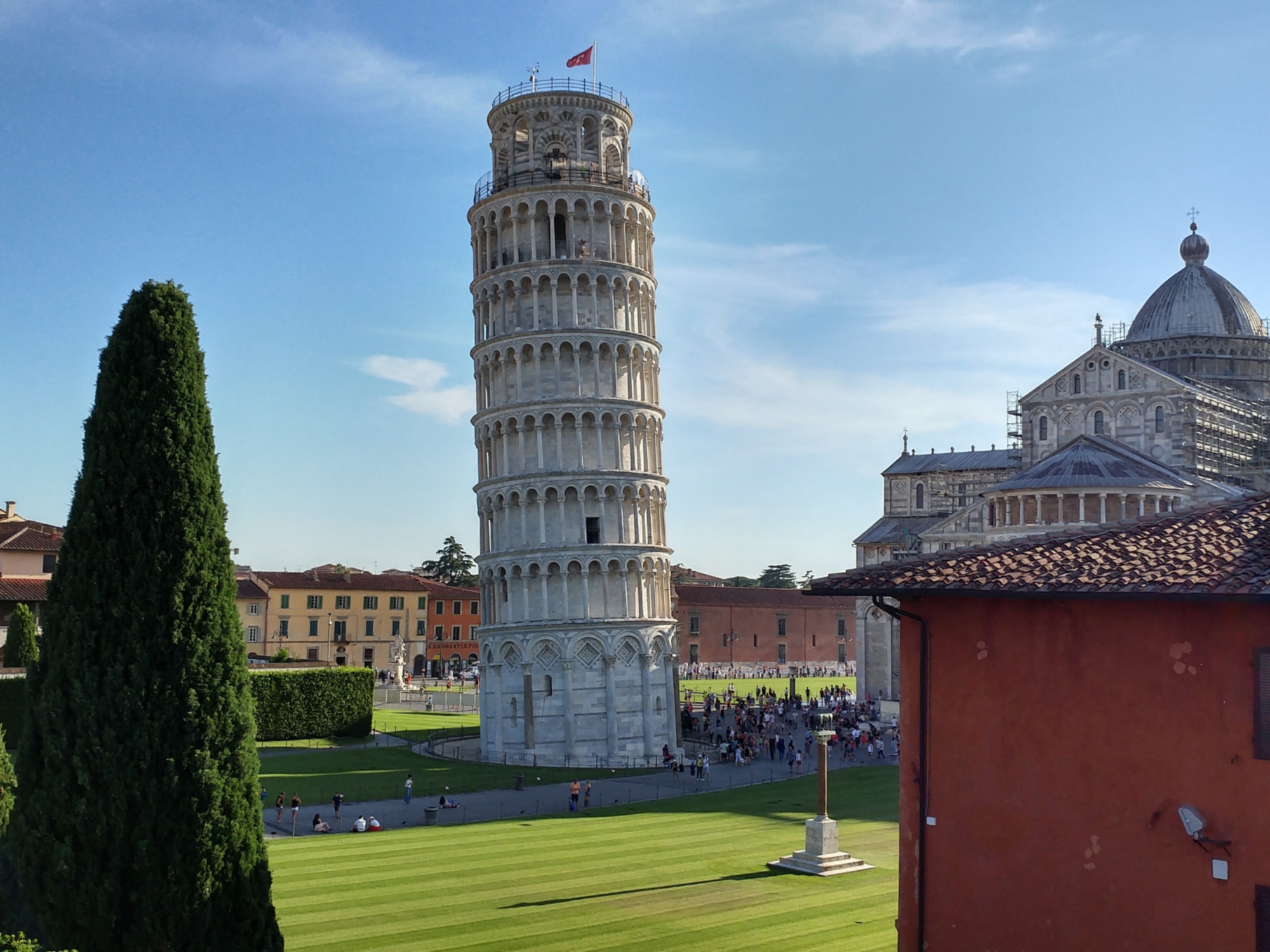
Even at the gates of Lucca a wonderful rural picture opens up, consisting of villas, villages, parish churches. The route, always easy, keeps at the foot of the hills and then climbs along the slopes of Mount Pisano, alternating paths and paved roads and crossing remote places of worship and medieval fortresses such as the Ripafratta Fortress, an outpost on the border between Pisa and Lucca, today an evocative ruin. Amid cultivated fields and canals, one sees the symbol of Pisa, its Leaning Tower, pop up. Quickly past the suburbs, Piazza dei Miracoli shows itself in all its artistic and architectural beauty.
Even at the gates of Lucca a wonderful rural picture opens up, consisting of villas, villages, parish churches. The route, always easy, keeps at the foot of the hills and then climbs along the slopes of Mount Pisano, alternating paths and paved roads and crossing remote places of worship and medieval fortresses such as the Ripafratta Fortress, an outpost on the border between Pisa and Lucca, today an evocative ruin. Amid cultivated fields and canals, one sees the symbol of Pisa, its Leaning Tower, pop up. Quickly past the suburbs, Piazza dei Miracoli shows itself in all its artistic and architectural beauty.
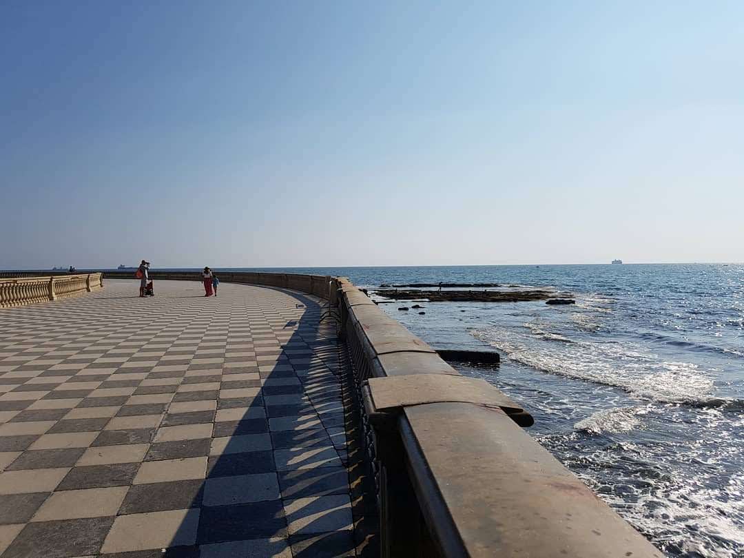
The two Tuscan maritime cities divided by history and their proverbial rivalry, united by the last spectacular stage of the Way of St. Jacopo. The most challenging of all, it leaves the city of Pisa by following the Lungarno and passing through the Porta a Mare gate. The route leads into the middle of the countryside and into the presence of the Basilica of San Piero a Grado, a sublime example of Romanesque ecclesiastical architecture, and then, after passing through a pleasant pine forest, overlooks the sea and offers the opportunity for a nice, regenerating swim. Livorno is there shortly waiting with all its wonders, from the Medici fortress to the Venezia quarter, but the final destination of the stage and of the Way, is the Church of St. Jacopo in Acquaviva, a splendid religious building reflected in the sea and from which many pilgrims, yesterday as today, left the mainland to reach Santiago de Compostela.
The two Tuscan maritime cities divided by history and their proverbial rivalry, united by the last spectacular stage of the Way of St. Jacopo. The most challenging of all, it leaves the city of Pisa by following the Lungarno and passing through the Porta a Mare gate. The route leads into the middle of the countryside and into the presence of the Basilica of San Piero a Grado, a sublime example of Romanesque ecclesiastical architecture, and then, after passing through a pleasant pine forest, overlooks the sea and offers the opportunity for a nice, regenerating swim. Livorno is there shortly waiting with all its wonders, from the Medici fortress to the Venezia quarter, but the final destination of the stage and of the Way, is the Church of St. Jacopo in Acquaviva, a splendid religious building reflected in the sea and from which many pilgrims, yesterday as today, left the mainland to reach Santiago de Compostela.