A journey from Pisa and Lucca following the aqueducts
The historic aqueducts are not only admirable monumental works, they’re also the roots that link cities to the nature that surrounds and supports them.
Following them surely means to be fascinated by the genius and efforts of those who made them, but also to rediscover, behind the seeming opposition between man and nature, an original and unique bond: like forest trees, cities also need water to grow.
In Tuscany, you can explore the Via degli Acquedotti, a beautiful hiking trail between Lucca and Pisa, following the Nottolini and Medici Aqueducts.
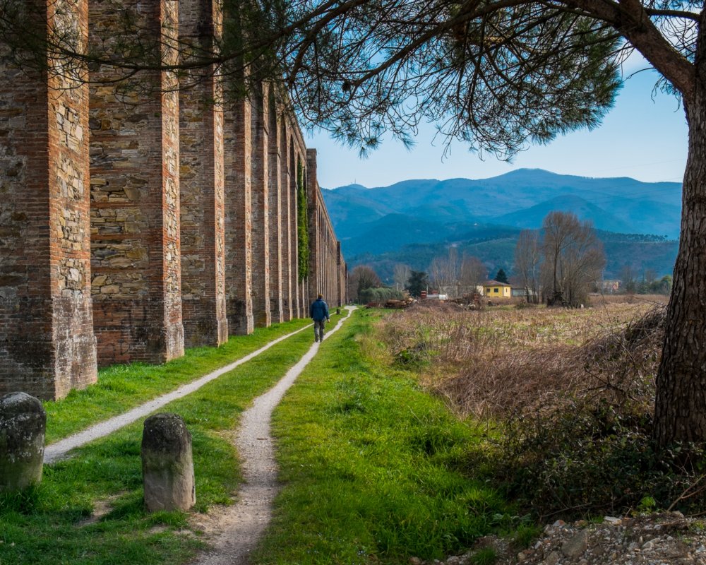
Up to the early 19th century, the supply and water to the city of Lucca was entrusted to wells that drew from underground resources below the city. Considering the scarcity and bad quality of this water, in 1822, Maria Teresa of Bourbon, Duchess of Lucca, hired the architect Nottolini to build an aqueduct that could bring water from the springs in the high plains near Serra Vespaiata and the Rio San Quirico and Rio della Valle streams. It took 10 years for the architect to construct the 460 arches of the three-km aqueduct, bringing water to the city walls with two separate pipes: one for spring water, intended for drinking, and the other for water taken from the streams, used to fill the fountains inside the city.
Today, the aqueduct is no longer active, but its structure is perfectly intact, and marks the direction of our excursion.
The itinerary begins in the beautiful piazza del Duomo in Lucca, heading past the imposing city walls, through the underpass at the train station, and reaching the small temple-cistern of San Concordio, where the water transported through the overhead pipes once merged before being distributed throughout the city via a network of underground channels. From here, the walk follows the exact route of the aqueduct’s arches and, gradually, brings us to from the city to the green, cultivated countryside.
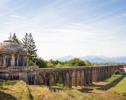
Nottolini’s spectacular arches end near the town of Guamo, where we come to another Neoclassical building similar to San Concordio. This is the small temple-cistern where the waters would merge before being directed into the two overhead pipes.
We now diverge from the exact route of the aqueduct, but the structure is still easy to see thanks to the presence of small brick filtering wells.
We shortly come to the town known as “With golden words,” a collecting place for the waters coming from the Serra Vespaiata. According to tradition, the curious name comes from the fact that the locals believed that the writing on a memorial stone set into the aqueduct was forged in gold lettering. In reality, it was brass that had clearly been well-polished!
The next part is a bit tiring: we have to climb two kilometres as we move on to Gallonzora, a panoramic town overlooking the Lucca plain. After this final push, the next part heads downhill to the beautiful village of Vorno.
The itinerary begins in the beautiful piazza del Duomo in Lucca, heading past the imposing city walls, through the underpass at the train station, and reaching the small temple-cistern of San Concordio, where the water transported through the overhead pipes once merged before being distributed throughout the city via a network of underground channels. From here, the walk follows the exact route of the aqueduct’s arches and, gradually, brings us to from the city to the green, cultivated countryside.
Nottolini’s spectacular arches end near the town of Guamo, where we come to another Neoclassical building similar to San Concordio. This is the small temple-cistern where the waters would merge before being directed into the two overhead pipes.
We now diverge from the exact route of the aqueduct, but the structure is still easy to see thanks to the presence of small brick filtering wells.
We shortly come to the town known as “With golden words,” a collecting place for the waters coming from the Serra Vespaiata. According to tradition, the curious name comes from the fact that the locals believed that the writing on a memorial stone set into the aqueduct was forged in gold lettering. In reality, it was brass that had clearly been well-polished!
The next part is a bit tiring: we have to climb two kilometres as we move on to Gallonzora, a panoramic town overlooking the Lucca plain. After this final push, the next part heads downhill to the beautiful village of Vorno.
Once we’ve left the village of Vorno, we start to climb up again, first along a stretch of asphalt road and then panoramic dirt trails, as we move toward the Campo di Croce pass.
From here, the next part is a descent into the oak forest on the Pisan side of the mountain. The downward stretch is first gradual, but then it becomes steeper as we get closer to Scarpa d’Orlando, where we come across one of the many water intakes of the springs that feed the Medici Aqueduct in Pisa.
Much older than its Lucchese “twin,” this hydraulic work was commissioned at the end of the 1500s by Ferdinand I de’ Medici and inaugurated in 1613 by his son Cosimo; it remained active for about 300 years, up to the early 1900s.
For hikers, the traces of the Medici Aqueduct are at first discreet and hardly striking. This is because it follows a stretch of the underground pipe that leads to the Cisternone, the large building intended for storing and settling water, decorated with the six balls of the unmistakable Medici crest.
Another brief stretch downhill brings us to the houses in Asciano, where we merge with a bike bath that follows the four kilometres of the straight aqueduct that lead to its end destination, piazza delle Gondole, now within Pisa’s city walls.
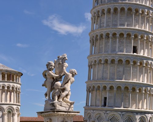
At this point, it would be worth continuing our journey for just a little while longer, following the route that leads to the Fontana dei Putti in the spectacular piazza dei Miracoli.
Once we’ve left the village of Vorno, we start to climb up again, first along a stretch of asphalt road and then panoramic dirt trails, as we move toward the Campo di Croce pass.
From here, the next part is a descent into the oak forest on the Pisan side of the mountain. The downward stretch is first gradual, but then it becomes steeper as we get closer to Scarpa d’Orlando, where we come across one of the many water intakes of the springs that feed the Medici Aqueduct in Pisa.
Much older than its Lucchese “twin,” this hydraulic work was commissioned at the end of the 1500s by Ferdinand I de’ Medici and inaugurated in 1613 by his son Cosimo; it remained active for about 300 years, up to the early 1900s.
For hikers, the traces of the Medici Aqueduct are at first discreet and hardly striking. This is because it follows a stretch of the underground pipe that leads to the Cisternone, the large building intended for storing and settling water, decorated with the six balls of the unmistakable Medici crest.
Another brief stretch downhill brings us to the houses in Asciano, where we merge with a bike bath that follows the four kilometres of the straight aqueduct that lead to its end destination, piazza delle Gondole, now within Pisa’s city walls.
At this point, it would be worth continuing our journey for just a little while longer, following the route that leads to the Fontana dei Putti in the spectacular piazza dei Miracoli.