Bottini in Siena
The ancient aqueducts extend like a labyrinth under the city
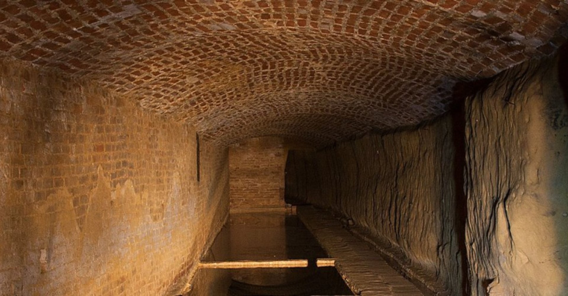
While walking the medieval streets of Siena and seeing the water springing from the Fonte Gaia in Piazza del Campo, it’s difficult to imagine that there’s an underground labyrinth stretching over 25 kilometers that supplies water to all the springs and wells scattered around the city. This network of underground aqueducts is called the Bottini, from buctinus, a term used for the first time in 1226 to describe the barrel vaults of the tunnels, which are typically about 1.8 meters tall and a bit less than a meter wide.
The aqueducts were mostly excavated from the 12th century through the 15th century to fix a water shortage, including one section called Fontanella that probably has Etruscan origins. Today, visitors can walk through these tunnels, where rainwater gets collected in the gorello (a small canal cut out of the walkway) that flows to the springs.
There are two fundamental branches of the Bottini spanning two different levels. One is the main branch of Fontebranda (7.5 km), which brings water from Fontebecci and the Chiarenna branch (in the north of Siena) to Fontebranda and runs quite deep. The second principal branch is for the Fonte Gaia. It’s the longest one at 15.7 kilometers, and the shallowest, feeding into the spring in Piazza del Campo and other low altitude areas.


